
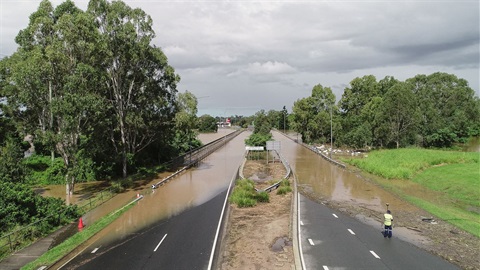
Logan City Council is preparing to investigate how ephemeral, or normally dry, creeks are identified in flood mapping as it responds to community concerns about the draft Logan Plan.
Council’s City Shape, Economic Transformation and Transport Committee will consider the proposed investigation’s scope on August 12, before making a recommendation to the Ordinary Council meeting on August 19.
Mayor Jon Raven said Council had listened to concerns from residents about minor rural gullies, farm dams and shallow waterways being included in flood risk mapping.
A Special Council meeting in June resolved to further investigate ephemeral creeks as part of broader considerations around flood mapping.
The proposed investigation would engage specialist expertise to examine the assumptions, methodology and application of creek flood mapping and related planning policies.
It would also include a more detailed technical assessment of waterways, looking at their function and characteristics to better distinguish creek systems from overland flow paths.
Mayor Raven said the work was intended to support a common-sense approach to defining creeks and determining when flooding should be identified and managed through land-use planning.
If Council endorses the scope, the findings will be presented to Council before any decisions are made.
Any future changes to creek flood mapping would continue to consider flood risks to people and property.
Both Council meetings will be open to the public and available to watch online.
More information on the improvements to flood mapping and policy endorsed by Council is available on a dedicated webpage at: logan.qld.gov.au/Floodmaps. It also provides updates, timelines, FAQs and background information.
Image source: logan.qld.gov.au