Logan City Council has endorsed a series of evidence-based improvements to the city’s flood mapping, aiming to provide residents with clearer and more practical information while maintaining protections for people and property.
The changes were approved at a Special Council meeting following an independent review of the Logan and Albert Rivers Flood Study and extensive community feedback.
Mayor Jon Raven said the reforms were designed to address concerns raised by residents during consultation on the draft Logan Plan.
“We heard loud and clear that the community wanted change,” Mayor Raven said. “These improvements will make a real difference for more than 25,000 properties across our city.”
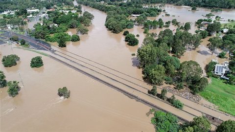
Among the key changes is the removal of flood events less likely than a one per cent annual chance flood, commonly known as a one-in-100-year event, from official flood maps. This includes the removal of the most extreme scenario, the Probable Maximum Flood (PMF), which will instead remain relevant for emergency planning purposes.
Council also approved clearer flood risk terminology, revised policies for small home extensions, updated approaches to mapping dry creeks and gullies, and improvements to the city’s online flood portal.
To fast-track the changes, Council endorsed the development of a Temporary Local Planning Instrument, allowing planning updates to be implemented sooner.
Mayor Raven said Council would continue working with the Queensland Government to deliver practical flood mapping outcomes for Logan residents and communities across the state.
Image source: logan.qld.gov.au